I wouldn’t necessarily recommend two 6,000m peaks in two days, but the forecast is set fair, and I’m carrying a lot of climbing gear, so why not?
Acotango (around 40km to the south) beckons: not too difficult, and quite an attractive looking volcano of reds and yellows with a cheeky little snow-cap on top. I hire a driver (because, apparently, it takes two to Acotango) and head off at 3am towards the Chilean border. After a few turns, a steep hill and a sulphur mine, the driver decides he’s gone far enough and stops. He looks concerned, and points up the valley muttering something about “seis miles” and “mucho frio”. I make a mental note to look this up later, as I am sure it’s important, but it’s quite parky, and I have a 6,000m peak to climb, so I crack on!
Striding purposefully, I’m pleased to discover that two weeks on a bike have worked wonders for acclimatisation. The same can’t be said for my sense of direction, as I find myself below the summit rise surrounded by penitentes. I can’t go much further this way, so I backtrack a few hundred metres and hop over the ridge where the snow is deep and crisp and even. On go the crampons, as I slog over two false summits before arriving at the flat summit ridge. The weather’s good (sunny with light winds) and I’m able to get some great shots with my drone – an idiot-proof technical marvel with settings that essentially allow “Dronio” to fly itself. I had reservations about buying this particular model, as its service ceiling is only supposed to be 4,000m. I wasn’t sure it would take off, but it’s having no trouble at all, even at this altitude. Incredible to think, not so long ago, I would have had to settle for a selfie or two. Now I can have 4k video that looks as if it’s been shot from a helicopter.
Undaunted by another early start, I hire a guide to climb Parinacota the following day. This is the fifth highest mountain in Bolivia and the second highest in the area. Definitely worth a pop. It’s a gorgeous cone-shaped mountain of snow and ice, straight from the volcano jelly-mould. We leave Sajama at 1.15am as, at 6,342m, it’s a very large jelly indeed. The snow conditions can be challenging, so an early start gives us options if we need to take a detour or two. As it turns out, the biggest challenge of the day is negotiating the locked gate the authorities (in their infinite wisdom) have put across the road to stop people driving up to where the climb starts <sigh>. This is made worse by our 4×4’s tendency to stall and not restart just when you think you’ve found a way round this bureaucratic twittery <double sigh>. But make it we do.
When the road runs out, we park/stall outside a mountain hut and walk up to the col between Parinacota and its sister mountain, Pomerape. The path then zig-zags left up to the snow-line at around 5,800m, before plunging into a 400m forest of pestilential penitentes guarding the mountain’s upper slopes. We flap about among these joyless pinnacles of ice for a couple of hours, before yomping up the final 100m of scree to the crater rim. I make myself unpopular with my guide by insisting we walk around the crater to the true high point (after all, a summit’s a summit) a further 20 minutes away. It’s a bit blowy, so no drone shots this time. Just a quick turnaround and back down again, this time taking a different route where the going’s a bit easier…
…a quick word about penitentes. When it snows in the Andes (and the phenomenon seems to be peculiar to this part of the world), the wind carves channels in the snow. These channels get deeper and deeper, leaving ridges that eventually form into carved pinnacles of ice. If you’ve been chewing too many coca leaves, these pinnacles might look like people kneeling in prayer – hence the name. While, in my humble opinion, a bit of penitence is no bad thing, but there’s a time and place. The time being on Sundays and the place being in a church, not half way up a mountain.
Safely back in Sajama, it’s time to restock our supplies of oats, noodles and tinned fish and head south. It’s 200km, as the condor flies, to the Salar de Uyuni and we have a choice of taking the direct route through Bolivia or a detour via the bodacious Lauca National Park in Chile. We decide to stay on the Bolivian side (better the devil you know) and, with around five days’ food, set a southward course on increasingly sandy roads. The wind is picking up too (although mostly from the north which is good) but we’re having to reduce the pressure in our tyres to 0.7 bar to get any sort of traction through the sand. Our Schwalbe Pickups are the widest cargo tyres we could find, but 2.6 inches is at the narrow end of what’s needed for this sort of work.
The scale of the landscape is deceptive. Mountains that appear to be five miles away turn out to be 25 miles distant, and gentle slopes to higher ground or a watershed can take half a day of constant grinding. The roads are uniformly terrible with a mixture of sand, stones and corrugations to test our patience as well as our tyres. We’re having to add more air or let the air out depending on the time of day and the surface we’re riding on. Hitting rocks with soft tyres is a good way of mashing an inner tube, so we have to take care (we only have one spare tube each).
We’re making reasonable progress considering, around 50km a day, so we’re not overly concerned about running out of food. There are small villages where we can get water, with exciting names such as Sacabaya and Buena Vista. But for the most part, these are rather small, run-down and dusty affairs with few facilities for tourists beyond an occasional small shop (tienda) and a tap to fill our water bottles. Curiously, many of the villages have 3G masts and sports halls – presumably some sort of government-sponsored programme to encourage people to stay, although they look a little incongruous. As I have a Bolivian SIM card, I’m happy to catch up on the news back home.
Equipment update! We’re carrying a three-man “MSR Mutha Hubba” tent, which is roomy and, allegedly, good in high winds. It only weighs 2kg and packs down rather well. But it’s billed as a three-season item, as the top half of the inner-tent is mesh rather than nylon. Most nights, so far, have been calm but, when the wind is blowing, a lot of the warmth inside is lost and the air can be filled with dust, coating everything, including nostrils, eyes, throats and other useful surfaces. Maybe a tent with a full liner would’ve been better for these conditions.
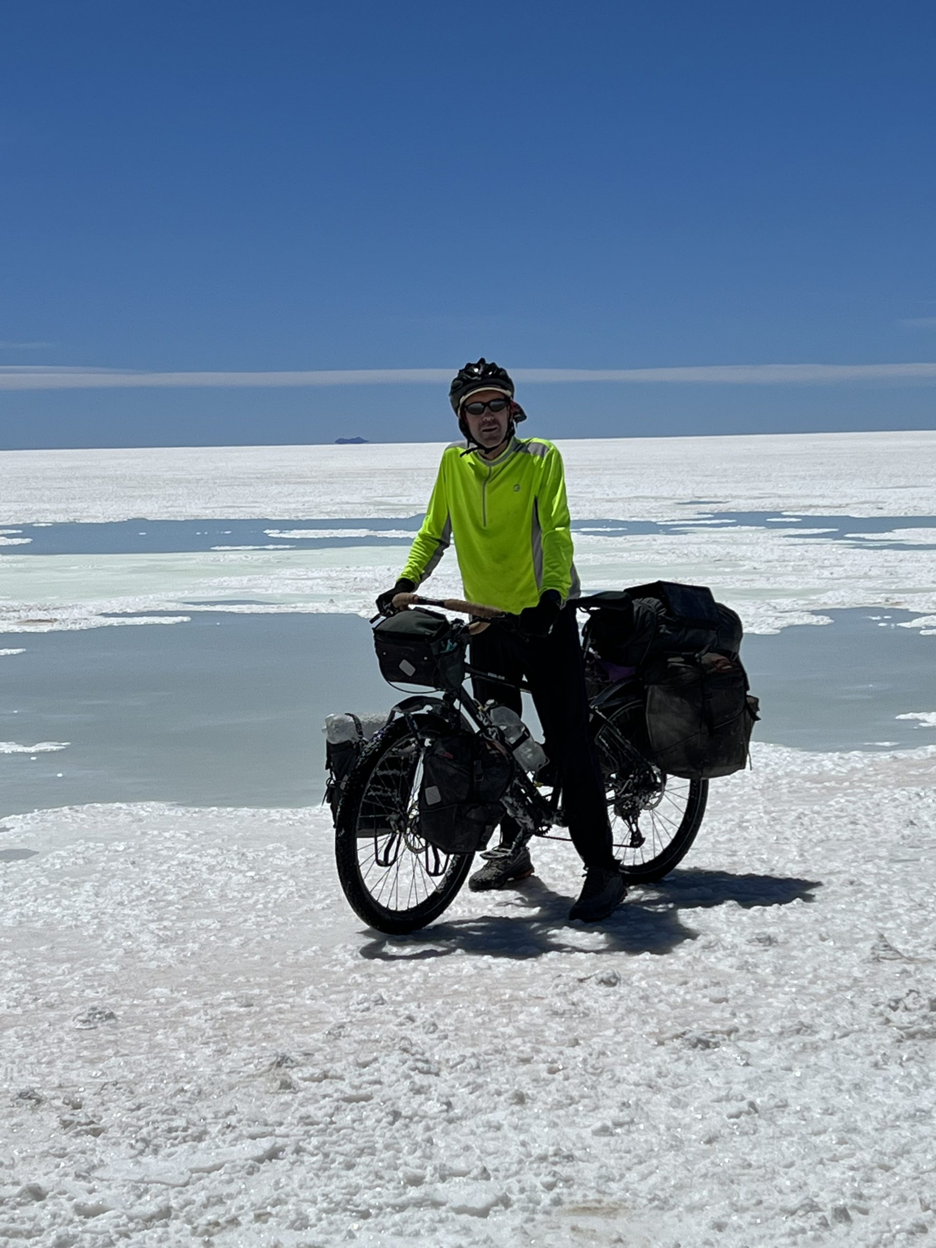
It’s day four after leaving Sajama and we hit the first part of the Coipasa salt flat. While “salt flat” does suggest “flat”, the surface ranges from smooth (nice) to lumpy (not nice) to soft icing sugar (unrideable). On the smooth bit we hit 13mph, our fastest speed in more than two weeks. We’re about to make a beeline to Coipasa pueblo (straight across the flat and comfortably the shortest route) when a local, in a 4×4, tells us to stick to the “coastline”, fearing we’ll sink into the briny depths. We follow his advice but, a couple of hours and three sides of a square later, we’re wondering if we should have taken our chances, who knows? Halfway round, we bump into a French couple, Bruno and Sophie, who are cycling the length of South America – it’s surprising we’ve got this far without meeting any other adventure cyclists. It must be a Covid thing.
From Coipasa pueblo, we face a similar choice. The “road” on the map goes straight across the main part of the salt flat. But on the ground there’s little traffic, and no clear path through the soup-like surface that threatens to coat us in salt and pickle us. We opt for the coastal route again, hoping to venture out onto the flats the following day, once we’ve worked out which way the other vehicles are going. As there are no other vehicles, we decide to wing it, picking a mountain on the other side of the flat about 20 miles away and heading out into a blinding haze of Damascene white. This proves to be a sound strategy, as we make as good progress as the lumpy surface allows (4-6mph). After three hours we hit water (there’s a lake marked on the map) and decide to keep riding, as the lake is shallow and the reflections of the sky on the lake are mesmerising. The colour of the surface changes to a darker green where the water is deeper, allowing us to navigate the final couple of kms without taking an unscheduled bath. It’s quite an experience to reflect on as we hose the salt off our bikes at the next village.
The final two days to the Salar de Uyuni give us smooth roads, around the bottom of the Coipasa salt flat, followed by a dusty climb between mountains over to Salinas, the biggest town in the area (not big at all). Here we enjoy a good lunch and a chat with a football team from Oruro. They’re in town for a tournament. It’s then another climb over a pass and down into Tahua for the next section of our journey.
To summarise. Time: seven days. Distance: 200 miles. Average speed: roughly the same as a hairy armadillo. Calories burnt: five million. Calories consumed: four million. Highlight: cycling through a salty lake. Low-point: sticking my foot into sulphurous gloop trying to take a picture of a flamingo (that flew off before I got close). Amount of dust expelled from nostrils each day: 34gm.
-

The nearest we've come to seeing a Hairy Andean Armadillo
-

Michael Flatley?
-

Sajama, our constant companion
-

If I build a lido, they will come!
-

One careful owner?
-

A welcome lunch in Sabaya
-

On the plus-side, dust means nice sunsets!
-

Ugh, corrugated ripio!
-

Salar de Coipasa
-

A road sign but no road!
-

Flamingos don’t mind the harsh conditions
-

Raised tracks in the salt
-

Water? What water?
-

Best till last
-

The sunset cycles through the spectrum twice for some reason
-

Did we miss the turn?