Goodbye Hotel Rosario, our home for the past four days, and hello dust, sand and freezing nights. The hotel’s been pretty empty (Covid, Bolivian unrest…?) and I’d like to think the staff are shedding tears of sorrow at our departure rather than laughter. But it’s probably the latter, as we fill the hotel foyer with bottles, bags and, er, more bags, piling them one on top of the other until the bikes are groaning under the weight.
The hotel manager looks at us quizzically as if to say, “Why are you jumping out of a warm and comfortable aircraft with a parachute strapped to your back, Señor?”. This is a fair question, as the route we have chosen, covering the 180 miles or so from La Paz to Sajama, is largely unpaved and, as far as we know, beyond the reach of Amazon Prime and Ocado. But if wanted comfort we wouldn’t be here; while people have scaled the highest mountains, plumbed the depths of the oceans and, apparently, found good places to eat in Watford, there are still adventures to be had on the paths less trodden.
The first challenge is getting out of La Paz, a city of around 800,000 that appears to have been washed, tidally, against the ramparts of the Bolivian altiplano. It’s going to be a 400m climb from there to El Alto, home to the airport and another million people, before heading out into a desert of hairy armadillos, mountain caracaras and the occasional pueblo selling Coka Quina.
Fortunately for cycle tourists, La Paz has a network of cable-cars whose names (red and yellow and blue and green) sound like a tribute to “The Sound of Music”. These little beauties allow people to descend daily from El Alto to La Paz to work, without adding to the already impressive levels of congestion. Our only complaint about an otherwise excellent system, is the lack of lifts for bikes (yes, I mean really!). Unpacking the bikes and lugging panniers, bottled water and everything else up a flight of stairs, while wearing a mask, is not an easy task at sea level. But at 3,600m, it’s like expelling a lung through a nostril, and about as pleasant. Nonetheless, it’s still a bargain and, having handed over the princely sum of 30p, we’re soon gliding above the streets and houses stuck to the side of the valley before topping the ridge and being deposited on the far side of El Alto.
We fill up our fuel bottles with two litres of Bolivia’s finest and, with a following wind and a heady mixture of dust and diesel fumes in our noses, wave goodbye to last place of any size we’ll see for the next five weeks.
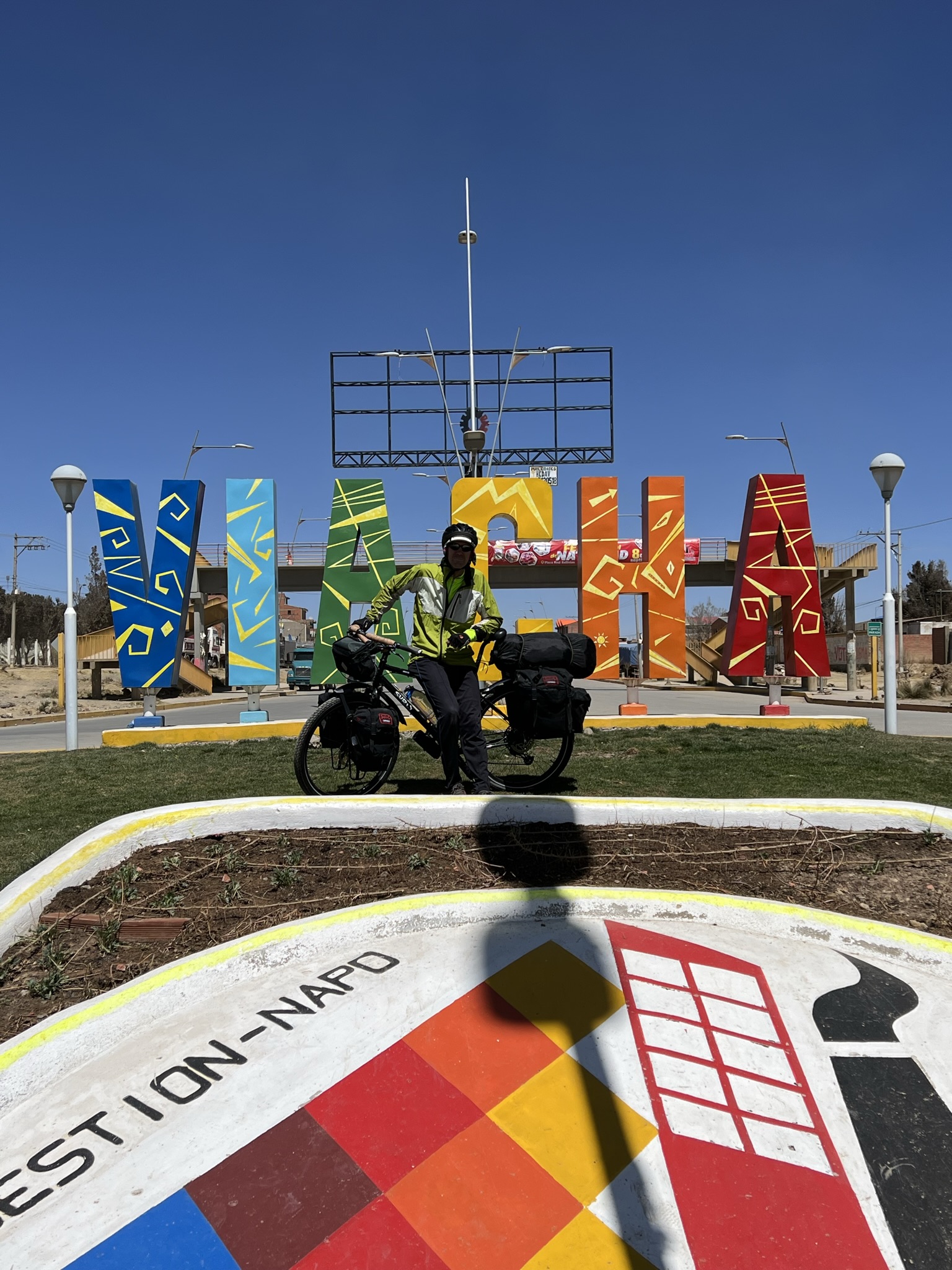
The road descends gently for 20 miles to Viacha where we stop for a lunch of soup, rice and chicken. This seems to be the only thing on the menu in many places, but does make ordering food a lot easier. This is a good thing, as we’re not fussy eaters, and the translation app we’re intending to use to order food, when our store of 11 Spanish words runs out, has started to produce some peculiar results.
As this is South America, famous for “el viento”, this may be a good time to talk about wind. According to the charts, the winds typically blow from the west (or the northwest) in this part of the world. This is a bit of a concern for a couple of reasons. First, the journey to Sajama is largely west (and south) and second, no matter which direction we’re cycling in, the compass on my handlebars insists we’re going northwest. On the first point, we’ve been reasonably lucky so far as the winds have not been, er, prevailing very much. On the second point, I later discover that various items in my bar-bag are magnetic. This is useful if I want know where my bar-bag is, but not all that helpful for navigating.
Meanwhile, the surface remains paved as we branch off the main road southwards. According to Garmin Explore (our bible for route-finding), our first stop is near a place called La Comanche. A good place to circle the wagons around a campfire you’d think. But the village itself is a dusty mining town offering little in terms of adventure apart from, um, soup, chicken and rice. Duly fortified, we find a secluded spot, beyond arrow-shot, a kilometre up the road where we pitch the tent, down a cup of coffee and retreat to our tent at around 7.30pm. When the sun goes down, the best place is inside.
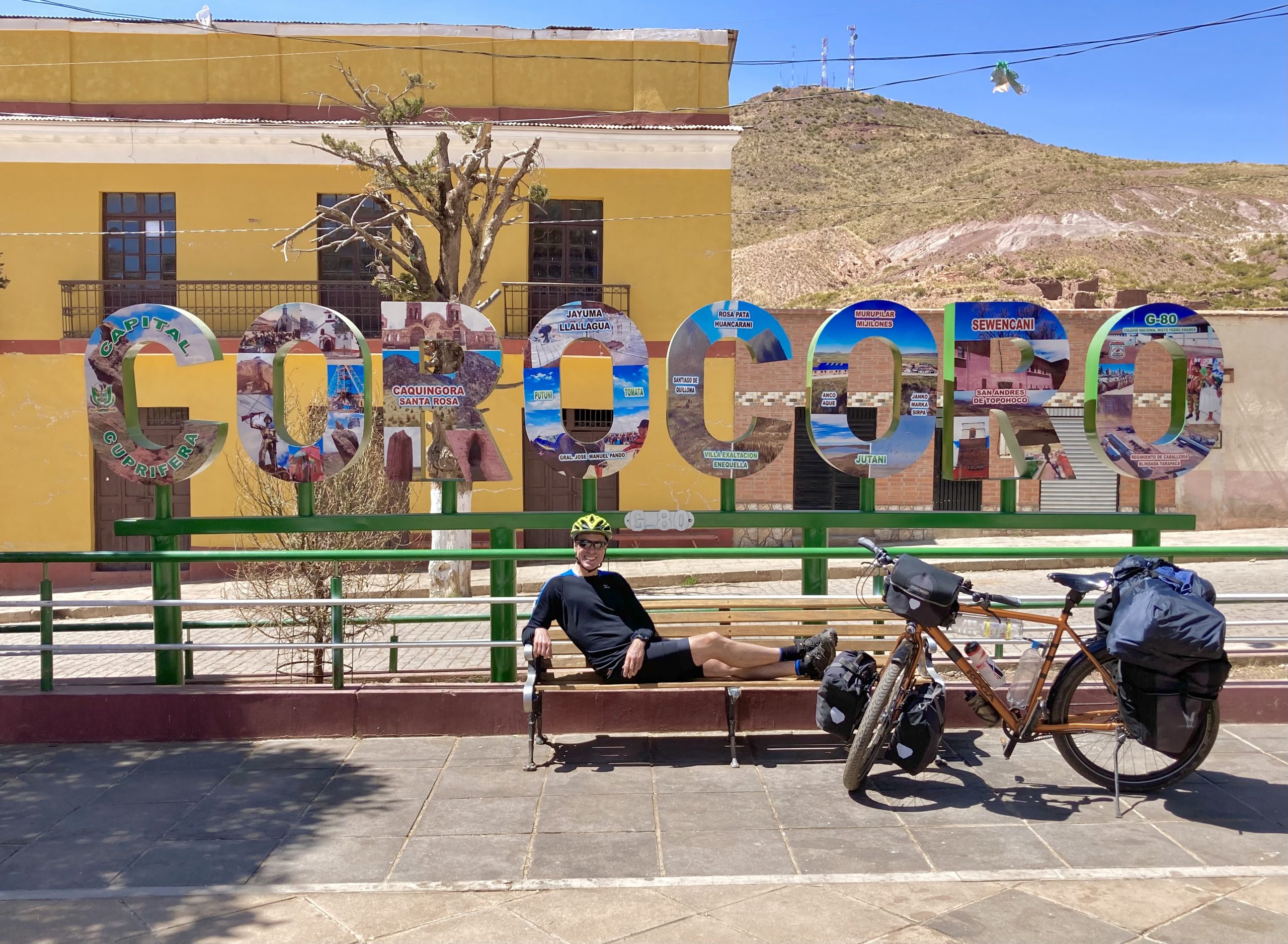
The following day the paving disappears and won’t be seen again this side of Sajama. [Note to self: not all “brown” roads on Garmin Explore are paved] We’ve just been through a village called General Ballivian and are wondering how bad a general he must have been to have this place named after him. At lunchtime we stop at Coro Coro, to enjoy cheese and crackers in front of a pack of drooling dogs. We’re hungry so don’t feel like sharing. The road out of town is a steep, stony and lung-busting slog, requiring several stops to recover our “composure” before we settle into an afternoon of ups and downs, with the occasional unplanned beaching as the wheels get stuck in the sand.
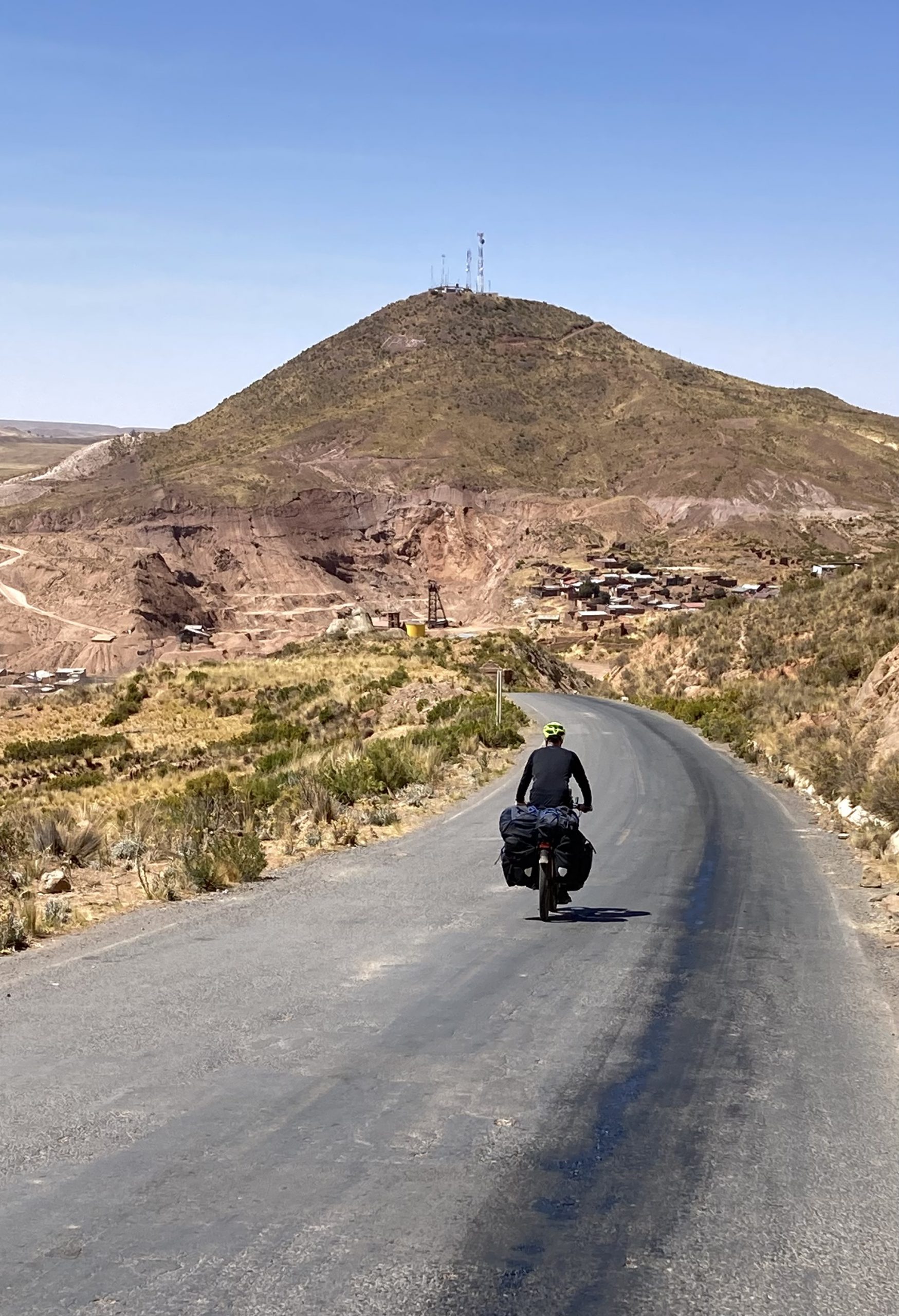
On the subject of roads, it’s rumoured that the Bolivians have 50 words for different road surfaces, 49 of which include expletives. It’s also said that reducing tyre pressure gives better traction on soft surfaces, although the jury is still out on that one. We’re already down to one bar and counting. For sure a 4×4 is the best way of navigating the roads around here, but for sheer comedy value it’s hard to beat two guys on overloaded bikes hitting sand and veering into spiky bushes.
One benefit of a bike over other forms of transport (except, possibly, the pogo stick), is the quality of the reception we get in villages of any size. In Calacoto we stop for ice-cream and coke, only to be met by a welcoming committee made up of the mayor and half the town council. There are many words with much gesticulating and, while we do not have much idea what’s being said, it’s agreed that this is a most auspicious occasion. Later a small group of women in local costume come up and ask me if I’d trade my friend for a couple of goats. At least I think that’s what they said. The translation app could be playing tricks again.
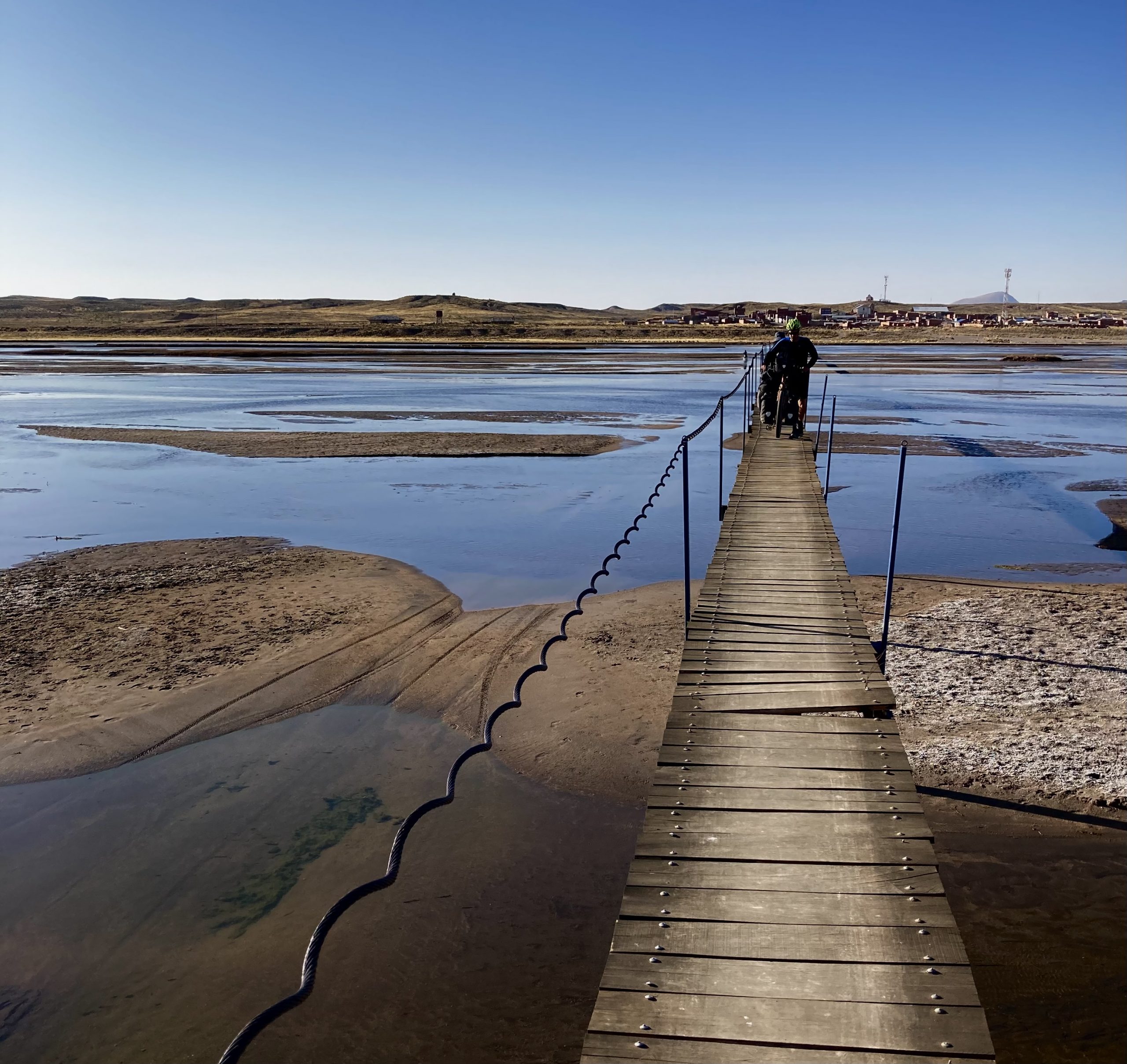
We leave Calacoto, following directions for the bridge over the river. This turns out to be a rickety footbridge barely wide enough for the bikes. We’re safely on the other side, when a man with a wheelbarrow asks if he can take a picture of the three of us. We readily agree, and it’s just as well as he owns the land on that side of the river and invites us to camp on a nice flat bit of ground nearby. With the tent up, Andy cooks and Derek gets some nice aerial footage with his drone – a fair division of labour!
South of Calacoto, the road becomes sandier and, increasingly, we use the tracks and other paths running beside or near the road, which offer a better surface. We’re aiming to get to Audiencia or beyond that day, but the side road doesn’t look promising so we stick with the “main road” instead. This takes us, by turns, to an increasingly arid area, where the streams flow through beds of salt and the landscape is pretty inhospitable. But we soon come to a village, where we buy coke and oranges and have lunch beside a bandstand in the main square. There aren’t many people around but there’s plenty of salt beside the road, heaped into tidy piles or moulded into blocks like giant bars of soap.
The next day we have a tough 250m climb up to a pass at 4,200m, our high point so far. It’s my birthday and Andy produces, from nowhere, a snickers bar, fruit pastilles and a birthday card from Cathy – items he has hidden from the start, the sneaky so-and-so! After the climb the road is undulating, and the tailwind helps, but there are no villages or other signs of life. The haciendas are deserted and there are no cars on the road, so water is becoming an issue. We’re about to draw lots on who’s for the pot, when we find a stream where we filter and treat water and wash the bikes (they do it with horses in the Westerns, so why not?).
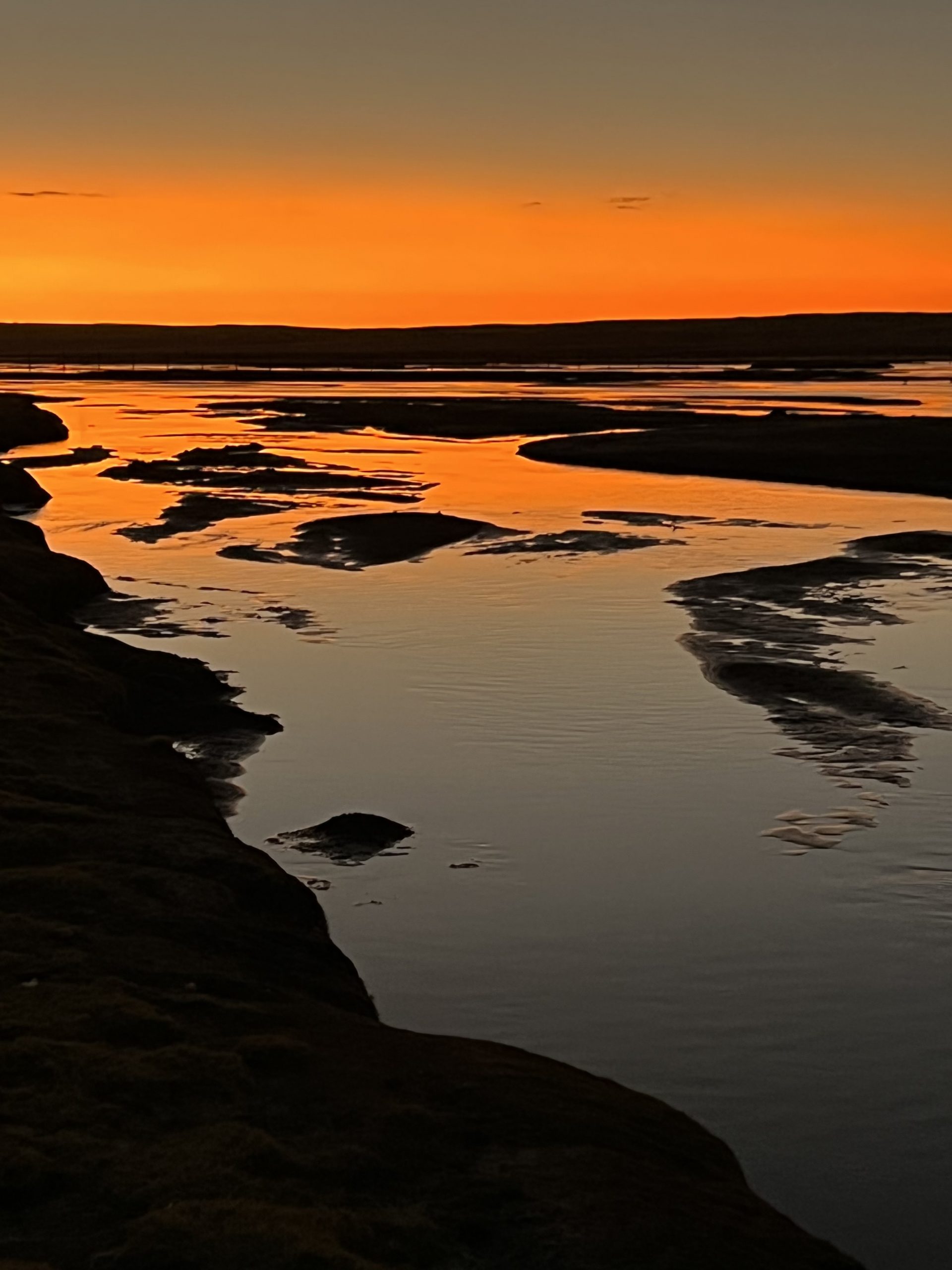
Heading south, we come across a few villages with wells and pumps. Maybe we’ve been past these pumps before and not recognised them, who knows? Eventually we get to Calicanto and find a perfect little spot down by the river, where we wash and watch the storm clouds pass by to the north. So far it’s been sunshine all the way, with daytime temperatures up to around 17C and night-time temperatures as low as -5C. No complaints though, as the wind has not been as strong as we’d feared.
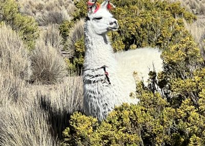
The next day I take some footage of Andy, using my drone in “track” mode. This works very well until later, when I discover I hit the stop-recording button by accident just as he sets off. Epic fail. Will try again later. Meanwhile, we stop for water and a snack in Pichaqa. Another deserted settlement although, as we see many llamas and are pursued by many dogs, it’s a fair assumption there are people living here who are out and about when we’re passing.
About dogs. Annoying little mutts that can spy a cyclist a kilometre away. Fleet of foot and seemingly willing to run vast distances to snarl and bark at you from close range. Andy’s more tolerant than I am, then again I’m more often at the back surrounded by a lot of angry hair and gnashing teeth. I do accept these dogs are doing the job they’re trained for (killing cyclists and protecting llamas 10km away) but I reserve the right to pick up rocks, sticks, grenade launchers and any other weapons that happen to be available to repel their advances. While often small in stature, the little gremlins are quite perky when hunting in packs. On these occasions, it helps to send the first volley of rocks at their leader.
Sajama (the mountain) is 6,542m high, making it the tallest mountain in Bolivia. It has dominated the skyline for most of the last four days, getting imperceptibly larger as we slog our way across the altiplano. We’re close now, and a quick right turn onto the “main” (ha ha, pull the other one) road sees us climbing a long, slow 300m rise to Tomerapi village, into a 3/4 headwind. Tomerapi might be the Bolivian translation for Shangri-La, as it has hot showers, comfy beds, washing facilities, loos and various other things we haven’t experienced lately. We’re greeted by a nice man at the Sajama National Park HQ who relieves us of 100 Bolivianos each and invites us to sign the visitors book. We note that the only other crazy cyclists who have been through here recently were a French couple a few weeks back in late August.
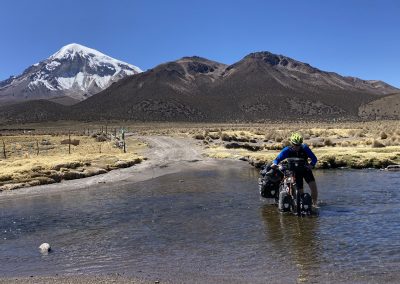
It’s the final day, with a short climb to the pass at 4,400m, followed by corrugated and sandy roads down to Sajama. We stop at the hot springs a few kilometres out of town and enjoy a warm bath in relatively shallow water. Apparently there are nicer baths nearby, but it’s early in the day and we don’t spend a lot of time looking around. Having forded the stream (again) we make our way into Sajama, the biggest town since Viacha, but really no more than a few hostels, a health centre and a lot of tumbleweed. Whoever’s been scaring away the tourists in La Paz has been at work here too.
For the next few days, this becomes a home from home and, like most of the other gringos in these parts, we congregate at Hostal Parinacota which has WiFi and endless cups of coffee.
The plan now is for Derek to climb Acotango and Parinacota over the few, before we set sail again south towards Uyuni. But we’ll have to see what Derek’s lungs and Pachamama have to say about that first.
-

Goodbye Hotel Rosario with your quirky knitted dolls…
-
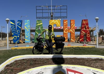
Viacha sounds quite bovine but is the last town of any size before San Pedro in Chile
-
Who are you looking at?
-
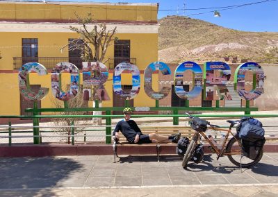
Practising “the look” in Coro Coro, shortly before the asphalt runs out
-

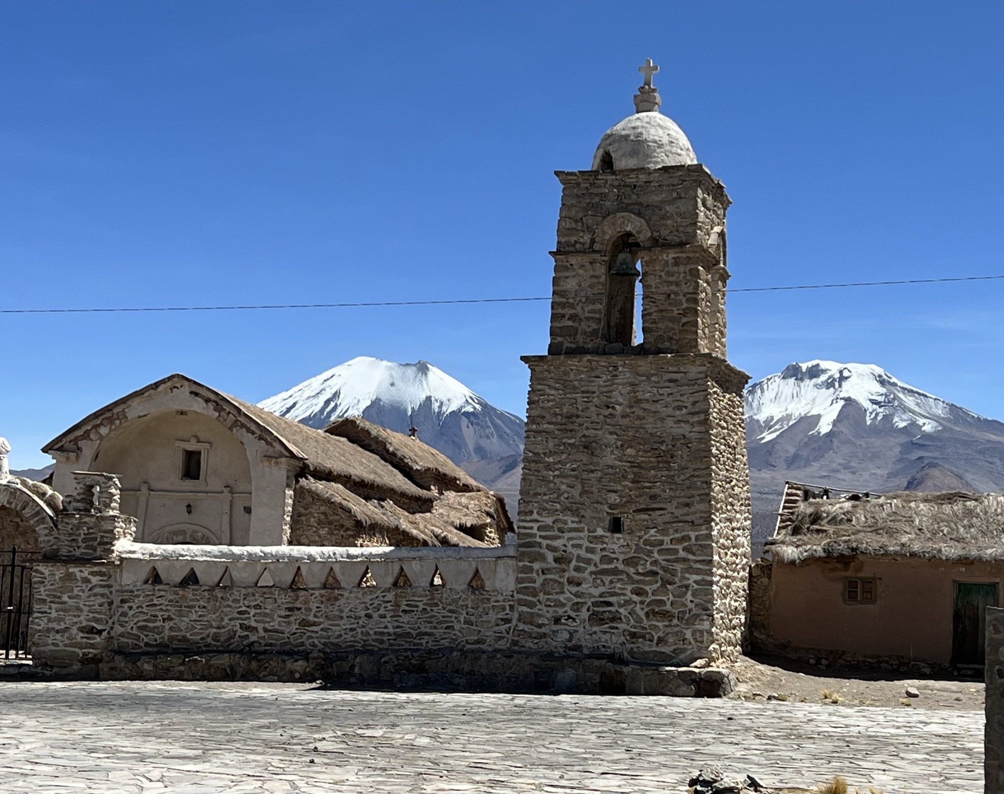
Every village has a church in varying states of repair
-

Cycling at 4,000m is never easy but it gets easier with practice!
-

It's wet feet or a precarious bridge scarcely wider than the bikes
-
A nice chap with a wheelbarrow says we can camp by the river, so why not?
-
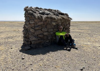
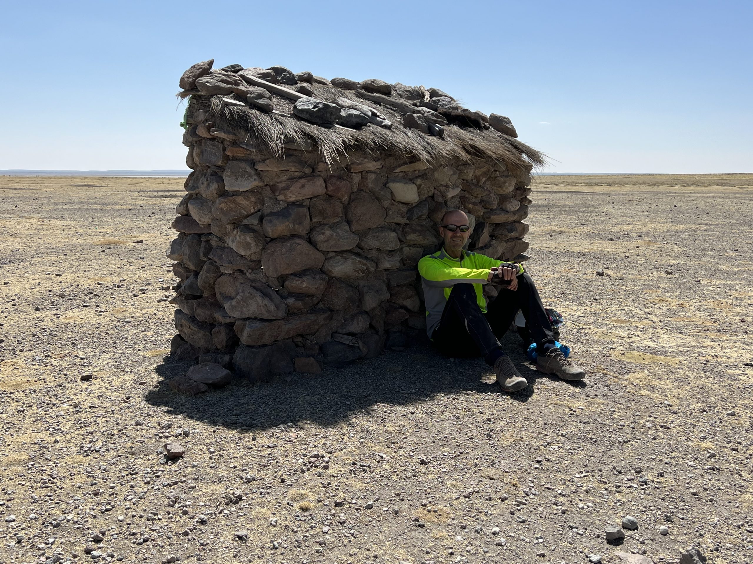
Any port in a storm
-
Are we nearly there yet?
-

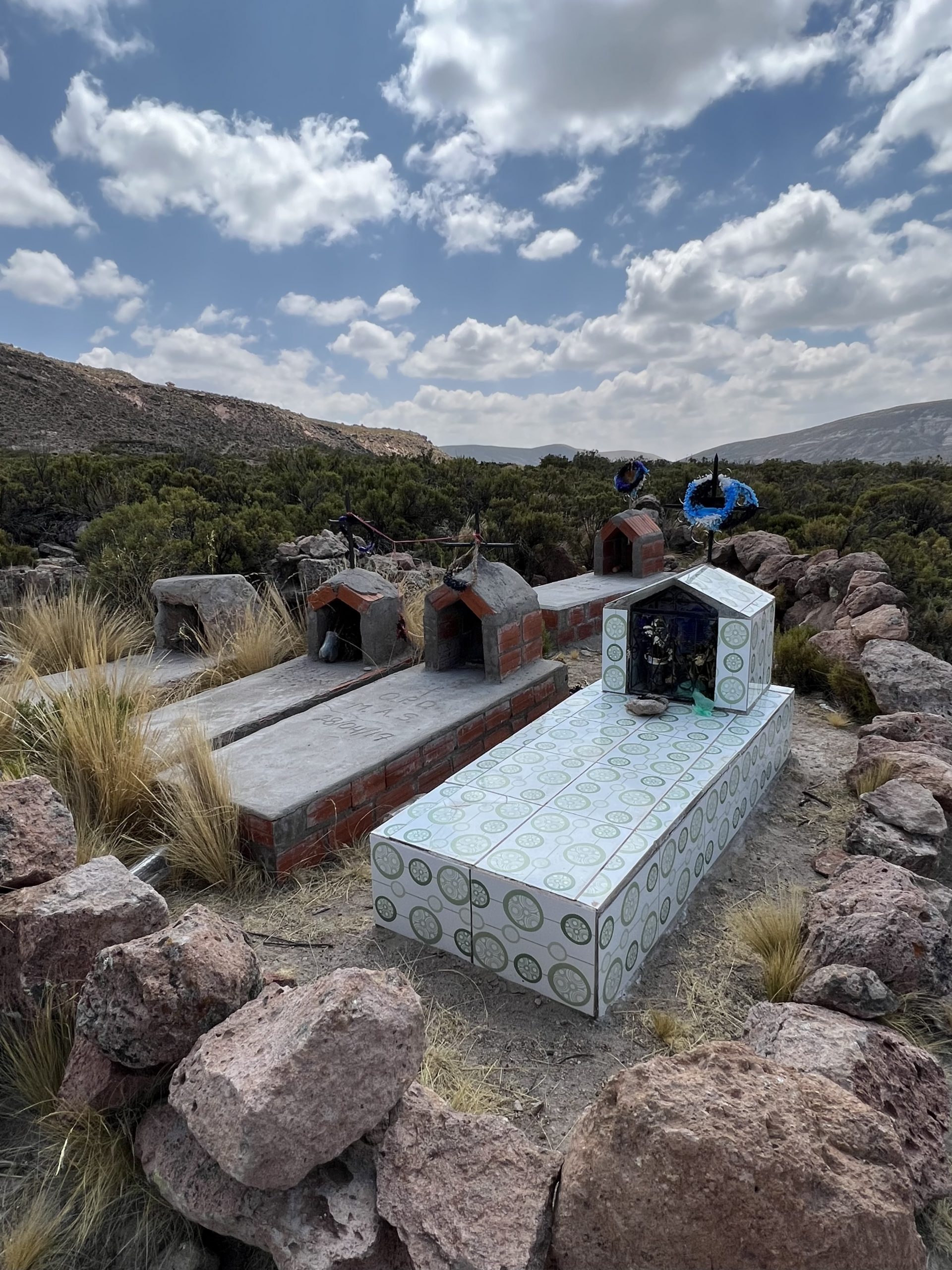
There are a lot of small (presumably family) graveyards
-

Sajama, the highest point in Bolivia, remains visible as far south as the Salar de Uyuni
-
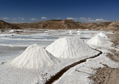
There's no shortage of salt in these parts
-

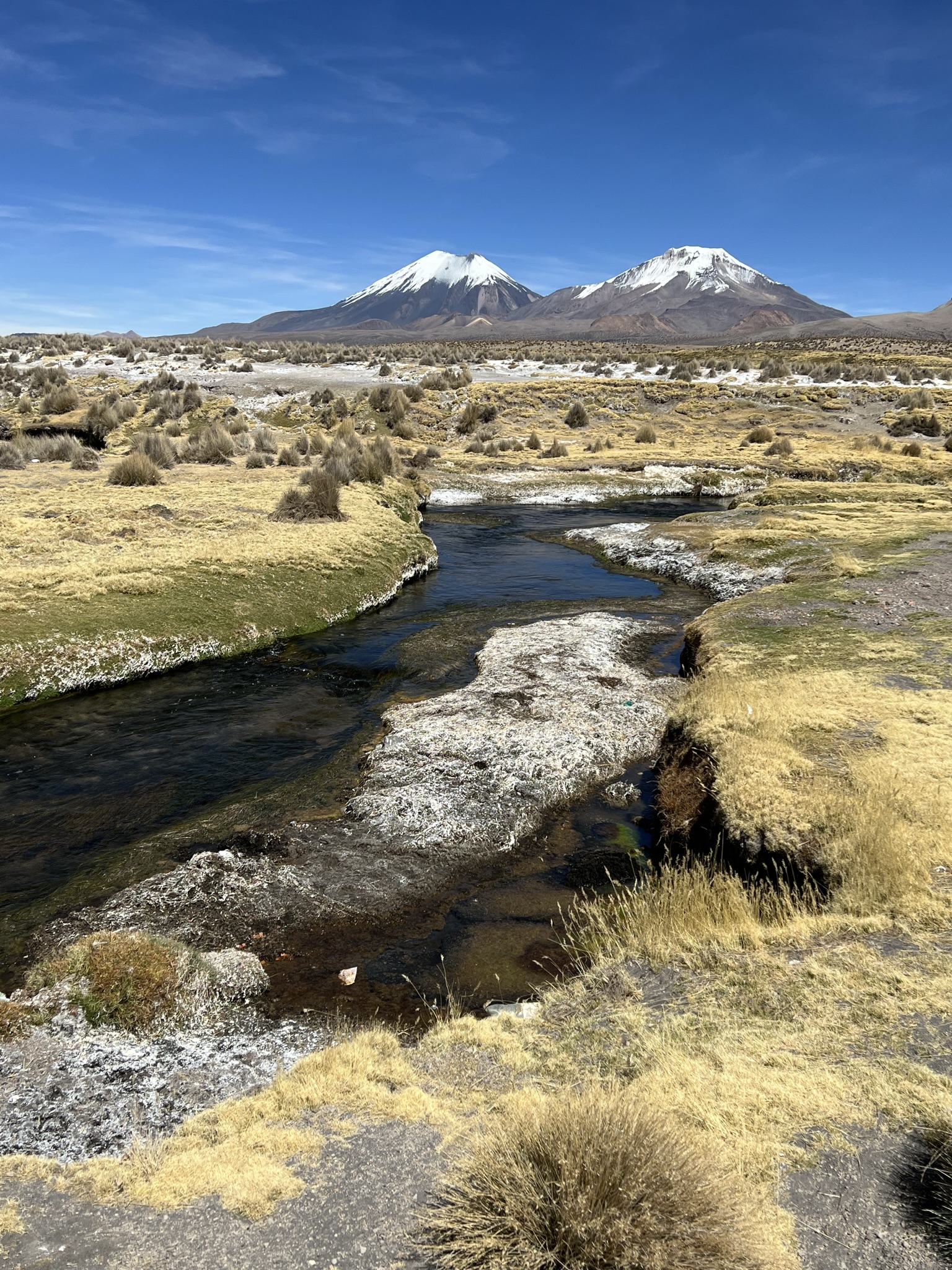
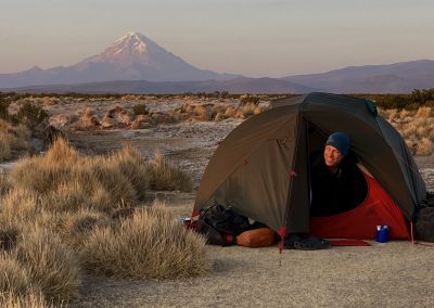
The twin peaks of Parinacota and Pomerape hove into view
-
Needs must when there are hot springs nearby
-
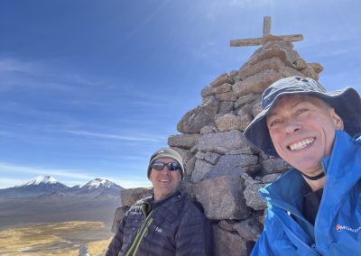
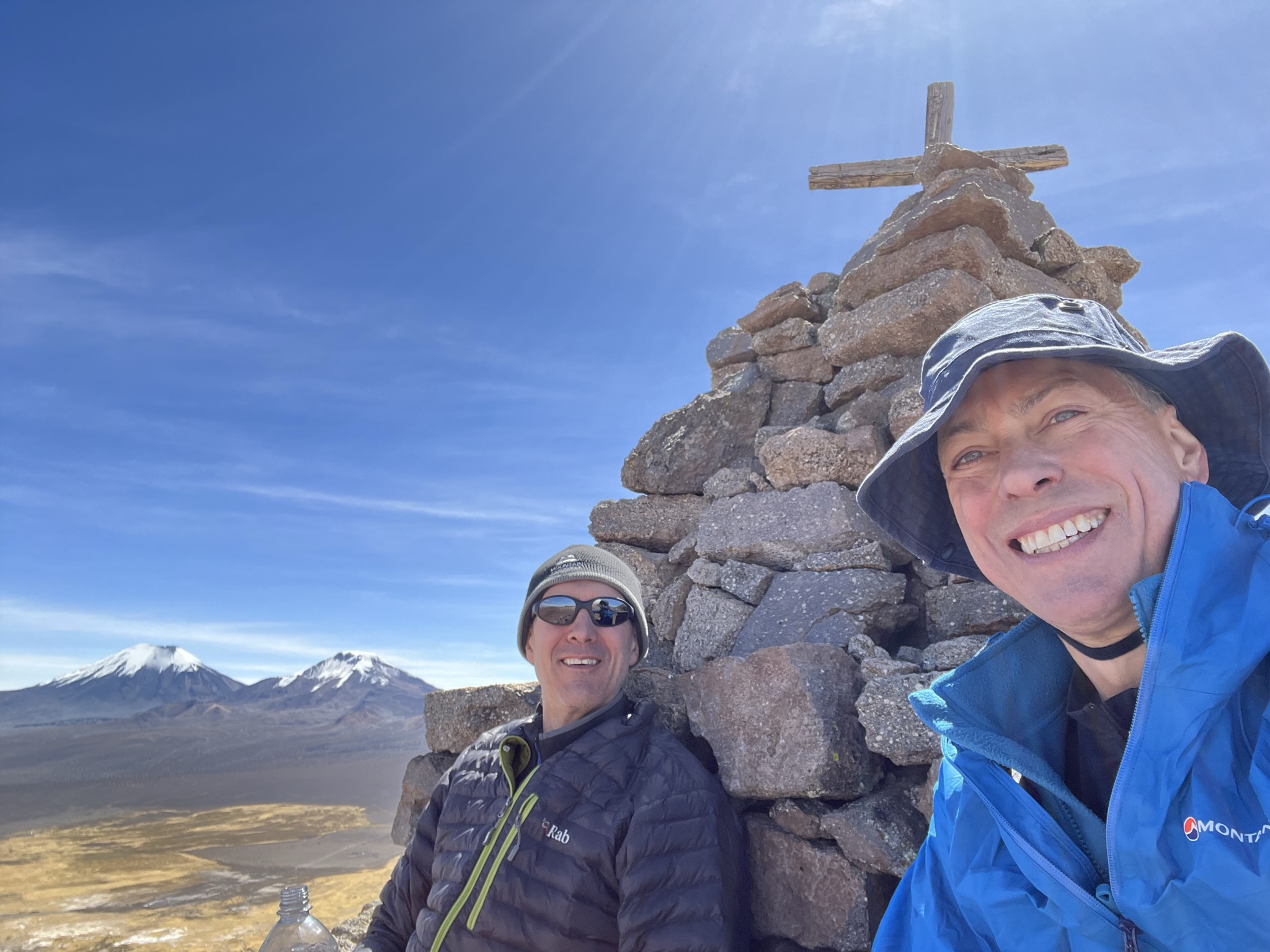
It's hard to smile wearing a silly hat but a peak is a peak!
-
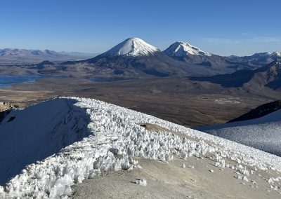
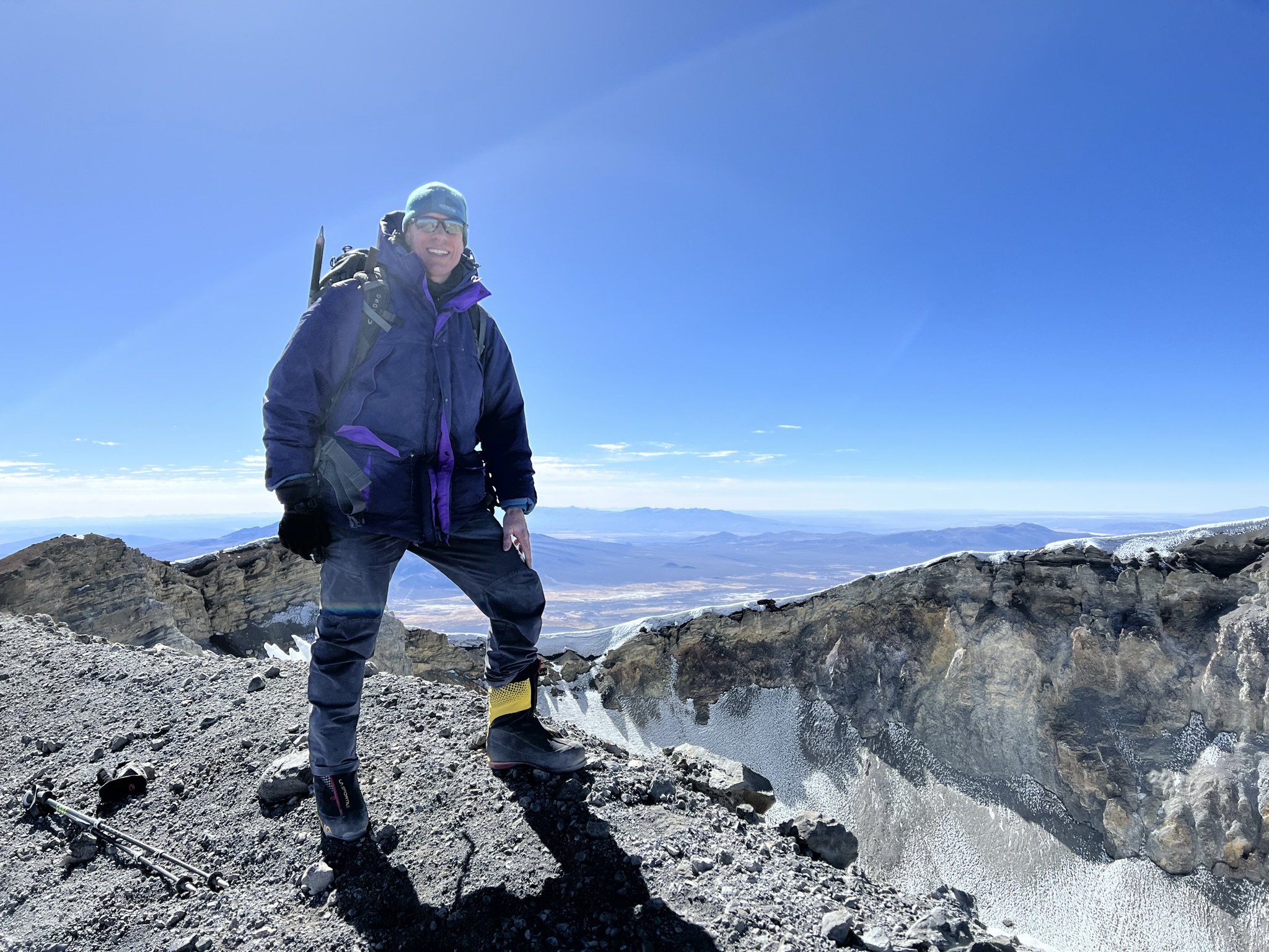
View from Acotango (6,052m) back towards Parinacota, my target for the following day
-
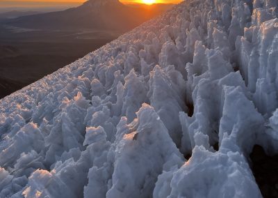
Penitentes on Parinacota. Pretty to look at, pretty unpleasant to climb over
-
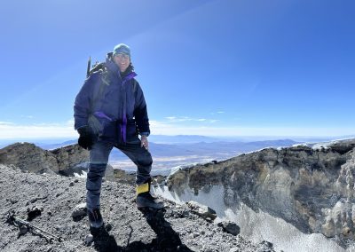
Yes, yes, yes!
-

Dust, dust everywhere